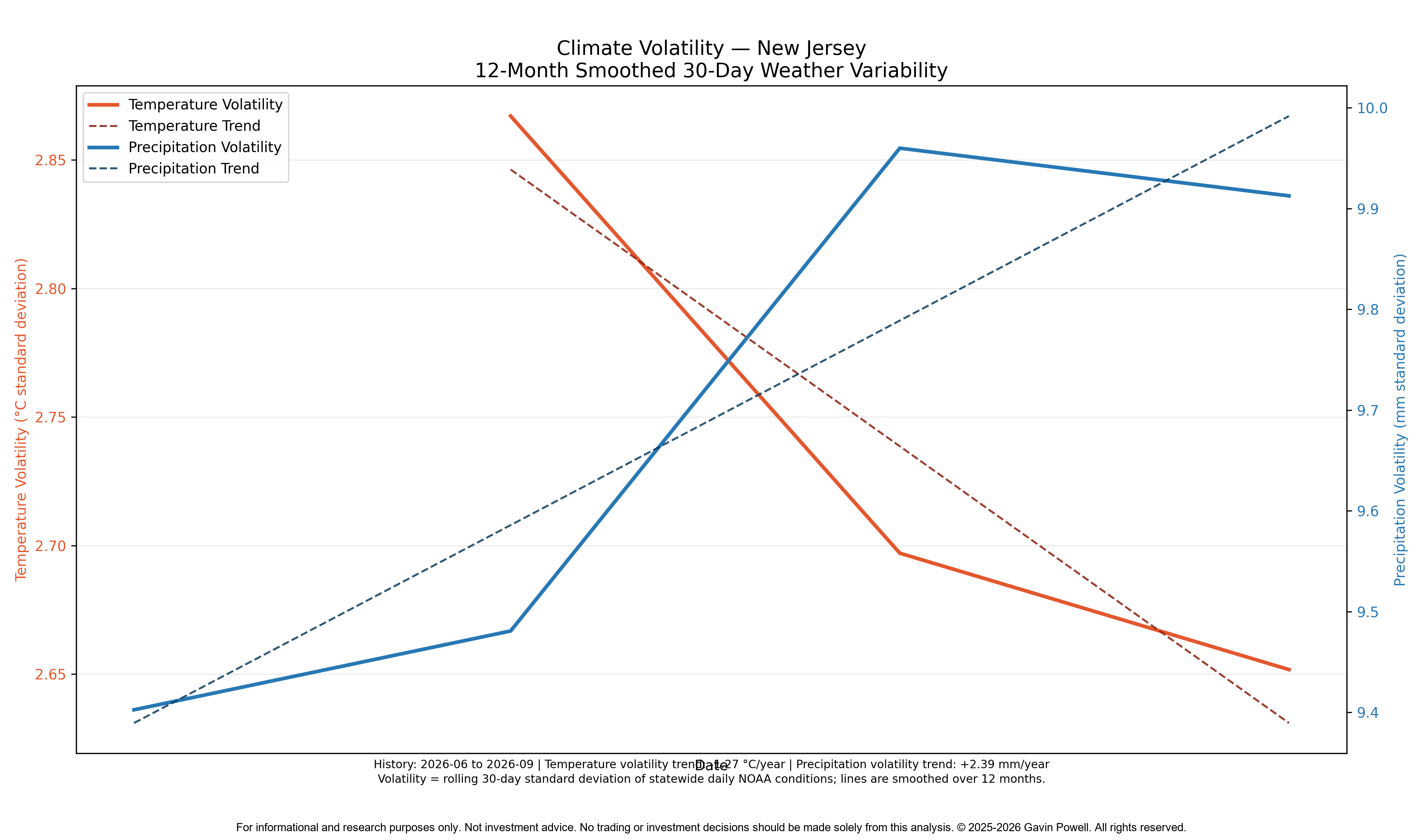
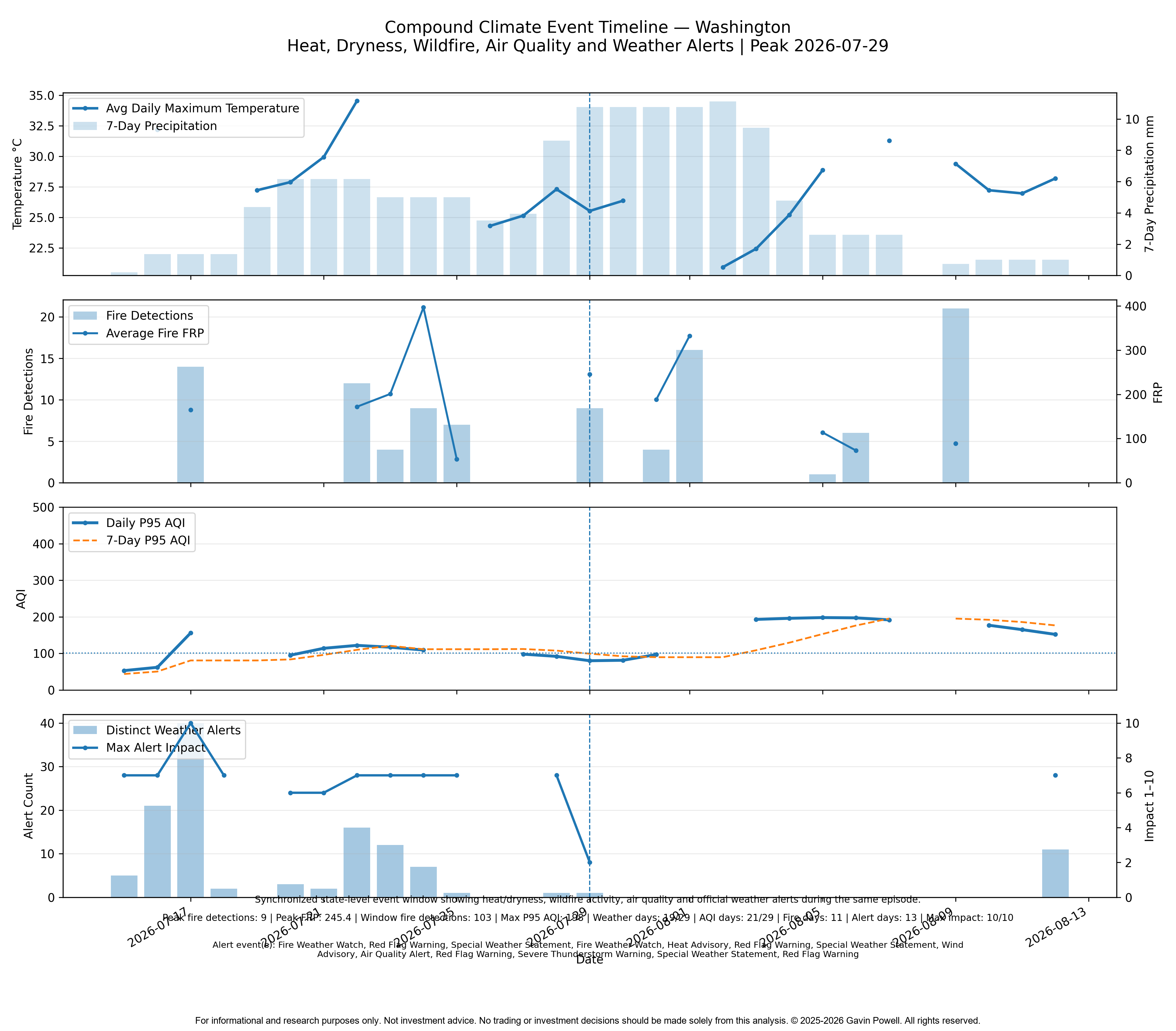
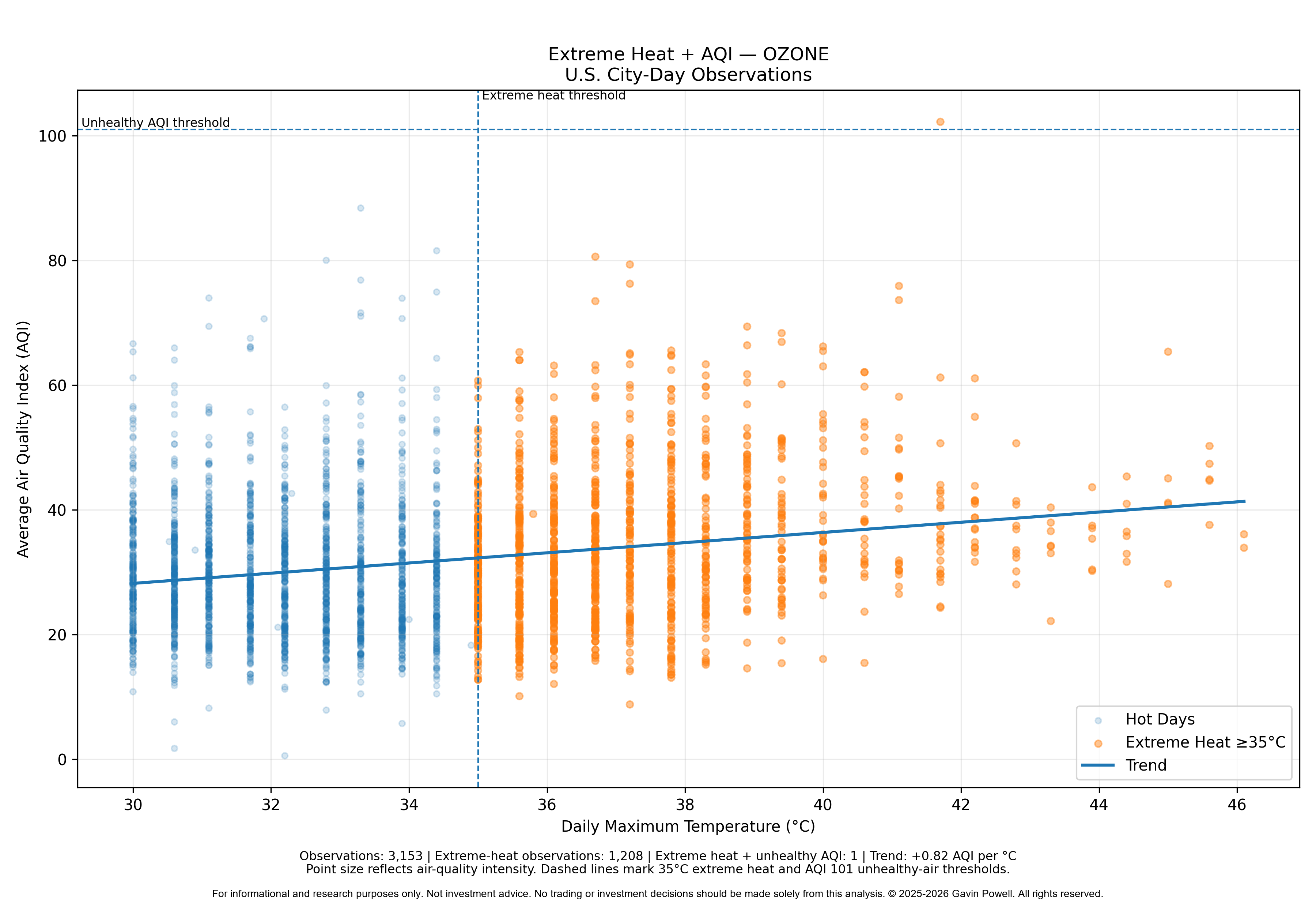
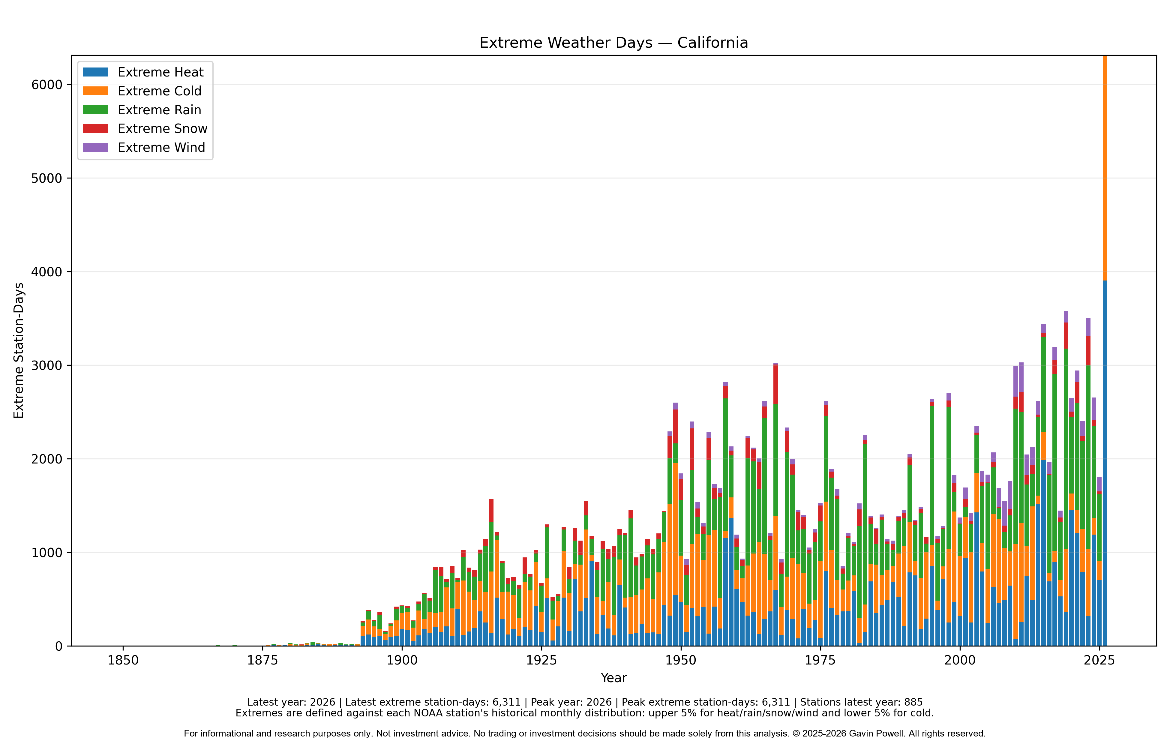
The underlying data pipelines and visualizations are refreshed automatically each day as new source data becomes available.
Climate, weather and environmental risk analysis combining temperature, precipitation, storms, wildfire, air quality, flood and geographic data to identify exposure, trends and vulnerable locations.
The underlying data pipelines and visualizations are refreshed automatically each day as new source data becomes available.